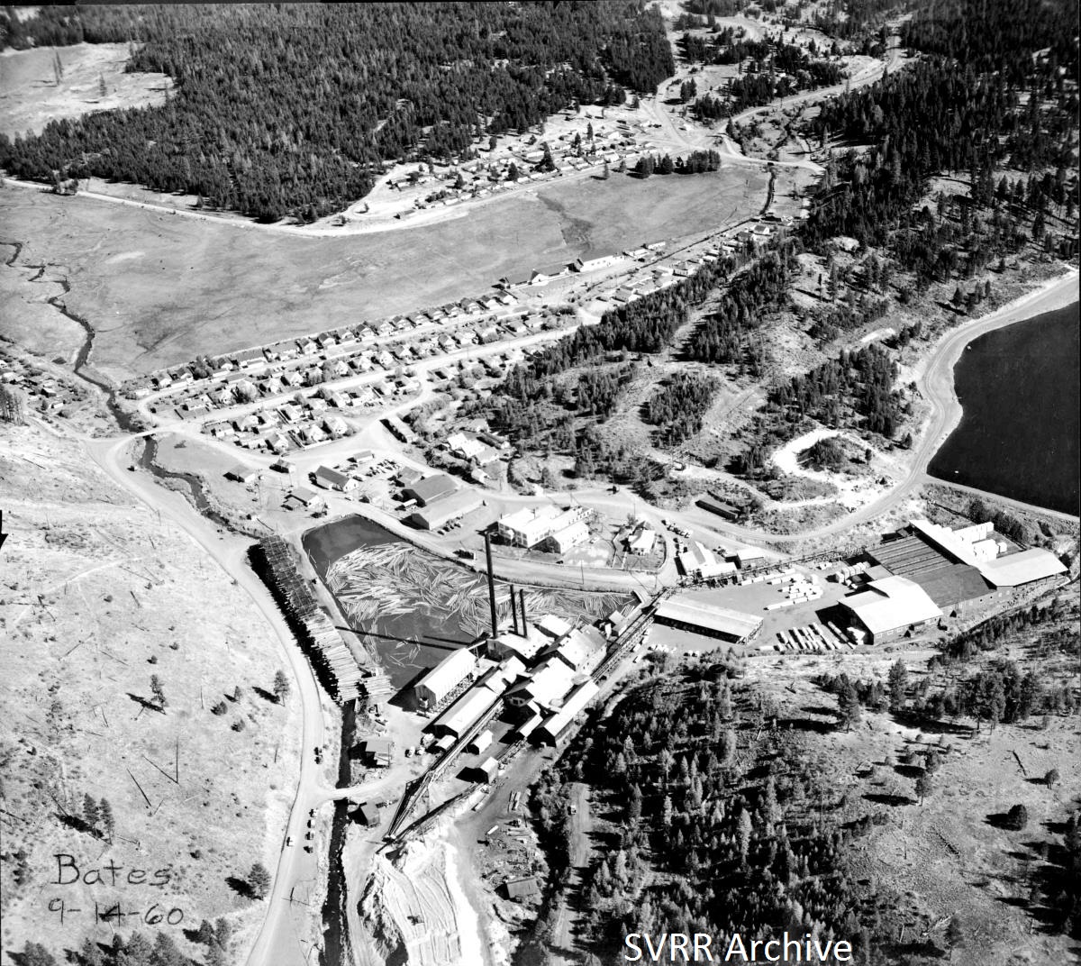
At a first glance, this photo might not seem to have any narrow gauge content, nor any railroad content at all. But bare with me and you will see that this scene is steeped in railroad history. This aerial view is of the company town of Bates, Oregon taken in 1960, which was 13 years after the Sumpter Valley Ry. was abandoned. At the time of this photo, the mill and town belonged to the Edward Hines Lumber Co. Bates was created in 1918 as Batesville by the Oregon Lumber Co. The Sumpter Valley Ry. passed trough the new town site on its way to Prarrie City. The railroad grade can be spotted on the left side of the photo by the small creek. The grade is then overlain with a road passing by the log pond. The upper pond to the right of the scene was built after railroad abandonment so is over the top of where the railroad ran up Bridge Cr. on its way to Prarrie City. Oregon Lumber Co. built a 20 plus mile logging railroad mainline down the Middle Fork of the John Day River. Spurs were built up the canyons on either side. The road just to the right of the "Bates 9-14-60" caption on the photo overlays this logging mainline. From 1918 to 1947, the narrow gauge Sumpter Valley Ry. carried lumber from the mill 60 miles to South Baker where there was finishing plant. From 1947 till 1962 Sumpter Valley Ry. owned Peterbilt trucks hauled the lumber. Today, the Bates mill site is a State Park, with very little left to remind us of this scene. The scan is from the SVRR Archive.
